Cyclist returns to New England High Country to unlock more champagne gravel on the back roads of Glen Innes, Tenterfield and Inverell
Words JOEL POTTER Photography ZOE BINDER
Maybe there’s something in the water up here.
The Northern Tablelands is undeniably beautiful country, with generally very agreeable weather, but there’s something else that clearly has a pull on people.
Having only recently been clued into the superb riding on offer in the New England region, I’ve been looking for any opportunity to explore more of its northern reaches by bike.
With a 100km loop mapped out and gravel rigs bolted to the roof, my friend Zoe and I made the seven-hour drive north from Sydney to Glen Innes, up Thunderbolts Way in unrelentingly torrential rain, seeking car-free roads and champagne surfaces.
We had no trouble at all finding those, but we were also lucky enough to meet an incredible group of locals who, as we discovered, all had something remarkable in common: they weren’t originally from here.
The Ngoorabul people have been connected to the land around Glen Innes for thousands of generations, but in the last 150 years the area has attracted Scottish, Irish, Cornish and Welsh settlers and, even more recently, our riding companions for the weekend.
So what is it that would make so many people pull up stumps and head almost to the Queensland border to make a new home? It barely took a pedal stroke to begin to understand just what that might be.
Just like a chocolate milkshake
The gradually rising chimes and buzzing vibration of my phone alarm wake me up, and I’m relieved to say the least.
After driving through some of the heaviest rain I’ve ever experienced the previous afternoon and with a dire forecast on the cards, I’d expected to wake to the sound of another 10-20mm.
It’s dead quiet outside; the sound of dry socks, at least for now.
We’ve got a decent day planned out, so a double breakfast is easily justified.
Oats and banana, maybe a couple of eggs for good measure? If it was race day, perhaps, but today is all about pure enjoyment so I give in to nostalgia and opt for Coco Pops.
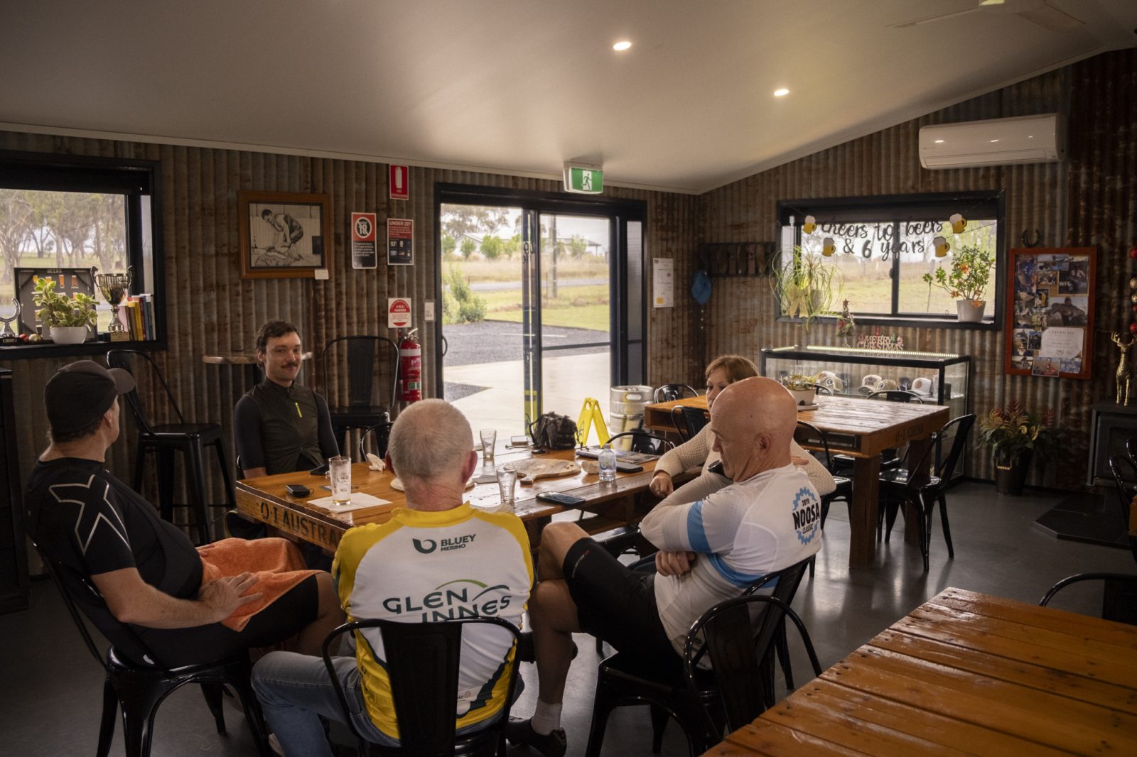
It’s just the fuel needed for the short commute from the outskirts of Glen Innes into town to meet our new riding buddies for coffee and something more substantial to eat.
We agree to meet at The Local to start the day, because it has the ideal combination of being open early enough and boasting the best coffee in town.
It’s a cafe that takes its name seriously, with a map on the wall showing just how local all of their suppliers are – from the coffee beans in my cappuccino to the eggs in the breakfast burger.
Second brekky includes an apple muffin and banana bread (that counts for two of your five a day, right?), both baked that morning while I was still sleeping off my dinosaur schnitzel from last night’s dinner.
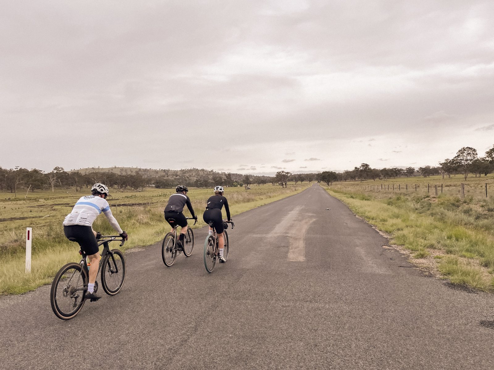
Meet and greets with Phil, Keith and Bernard who are joining us for the day sorted, we roll out, up the historic high street and straight onto the Gwydir Highway out of Glen Innes.
Heading west towards Inverell, we tick off the first few kilometres of tarmac as an easy lead-in to climb number one for the day.
The gentle 2km rise passes by without much interruption to our incessant gear and weather chat, but anyone who has raced the gruelling Grafton to Inverell probably remembers that hill differently, as one of the many lumps that really begin to sting the legs well past the halfway point of the race.
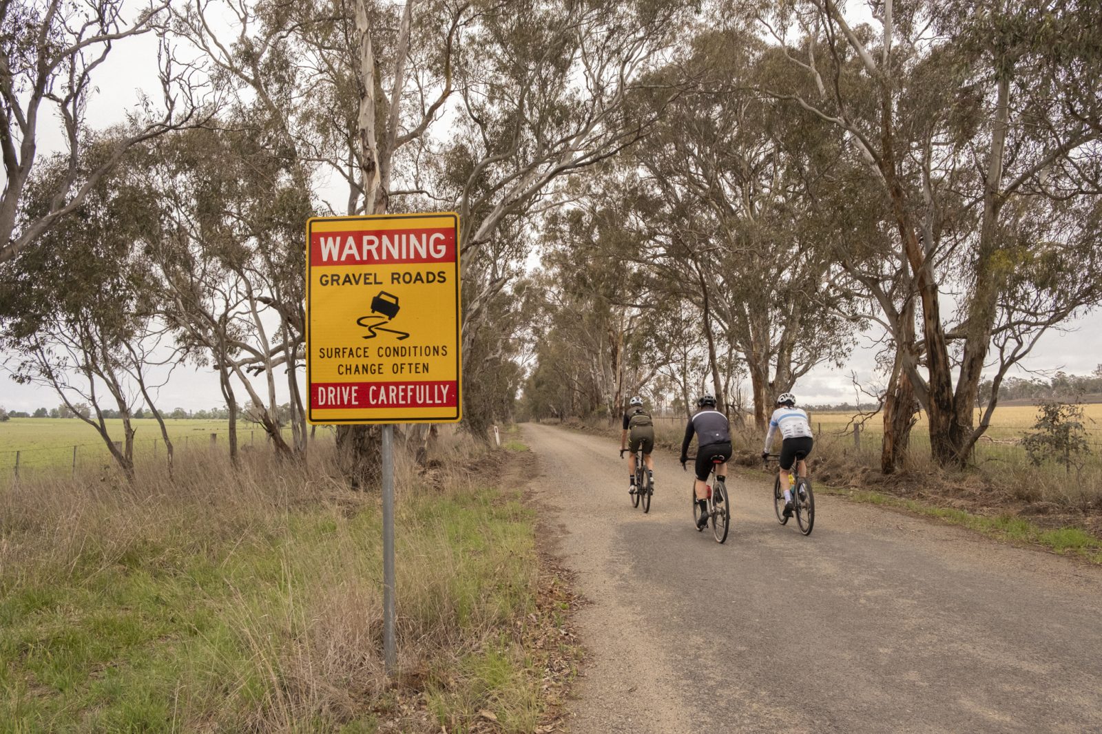
It’s remarkably quiet on the road, especially considering we’re riding on a highway, and before we have a chance to be passed by a single car we swing off it and onto Beaufort Road.
I had a more direct route to our first stop in Emmaville mapped on my Wahoo, but with this first turn, local knowledge begins to pay serious dividends thanks to Keith.
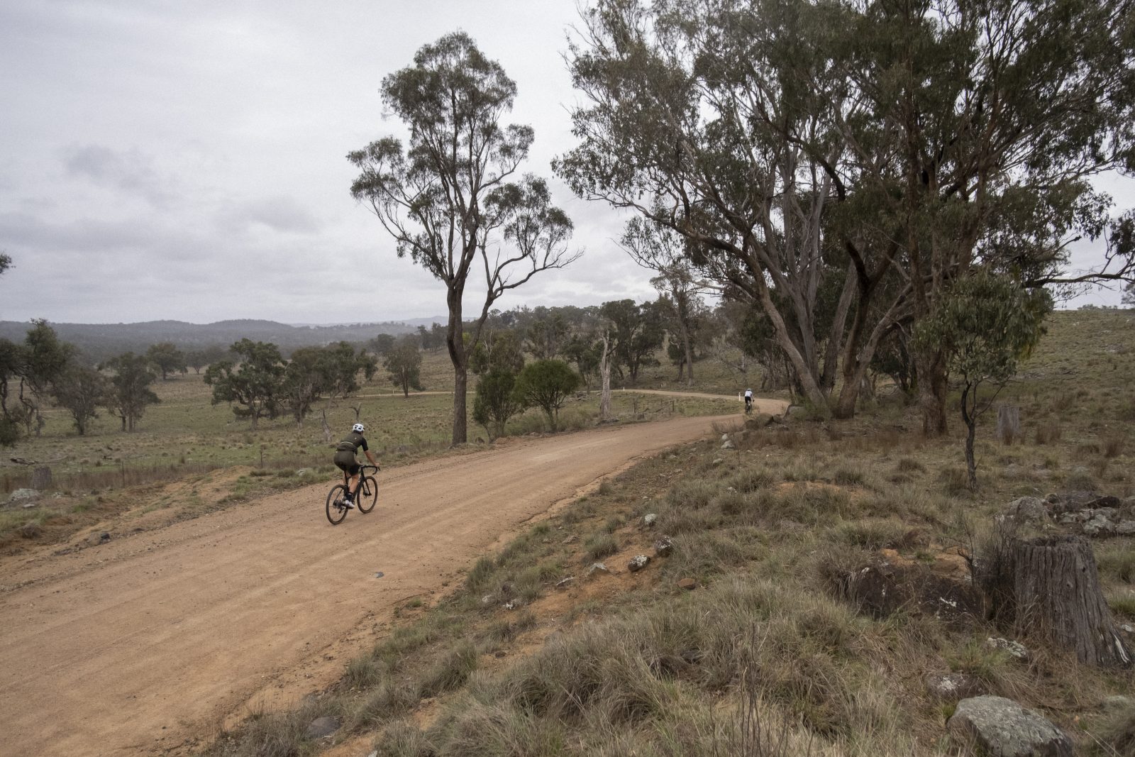
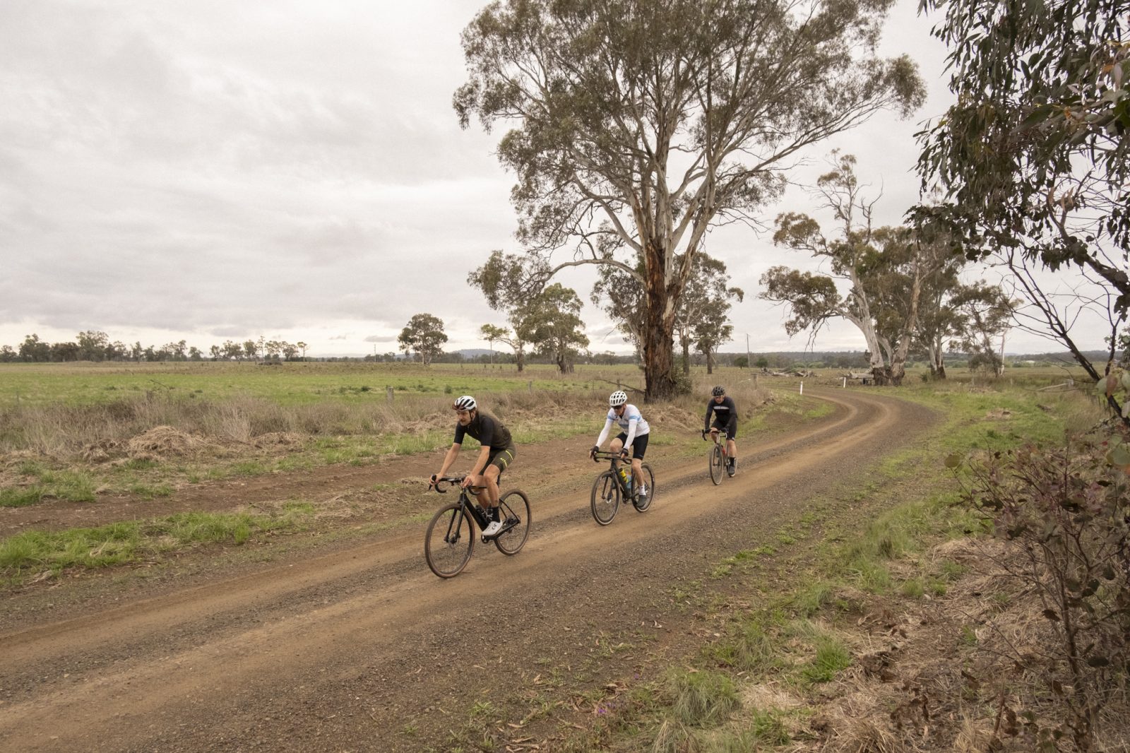
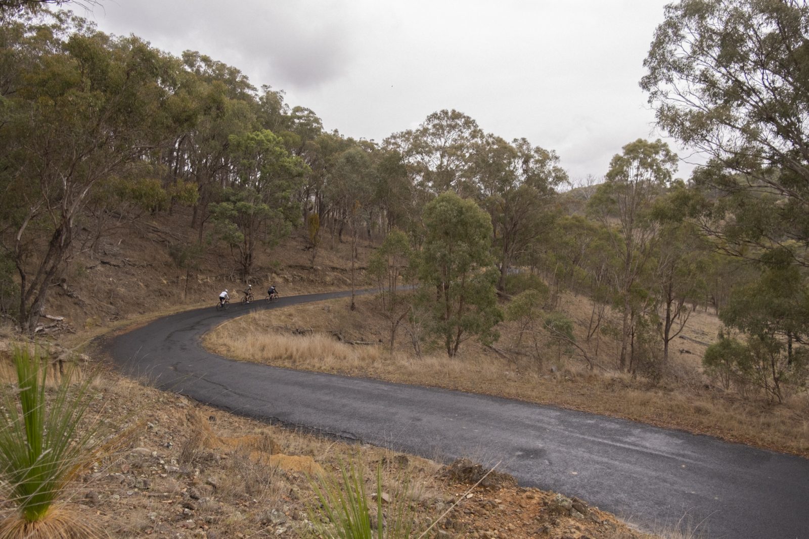
We’ve barely left the highway when the surface transforms from that typical, dead country chipseal into the kind of gravel most of us dream about.
Earn your turn
With names like Glencoe, Strathbogie and Stonehenge all around us, it’s hard to miss the Celtic heritage of the settlers who were drawn to this region in the 19th century, so much so that Glen Innes even has its own certified tartan.
It’s also very easy to see why it reminded them so strongly of the Scottish landscape they left behind.
Right now the air feels moist and the sky is ominously grey, but thankfully the weather stays ride-friendly.
To the left a small herd of black cows grazing in a very green paddock hear my chuckle of disbelief at the road stretching out ahead.
A picture-perfect strip of gravel, dead straight and lined on both sides with thick trees.
This isn’t just your average ‘local bubbly’ kind of gravel, this is D.O.P.-certified champagne gravel.
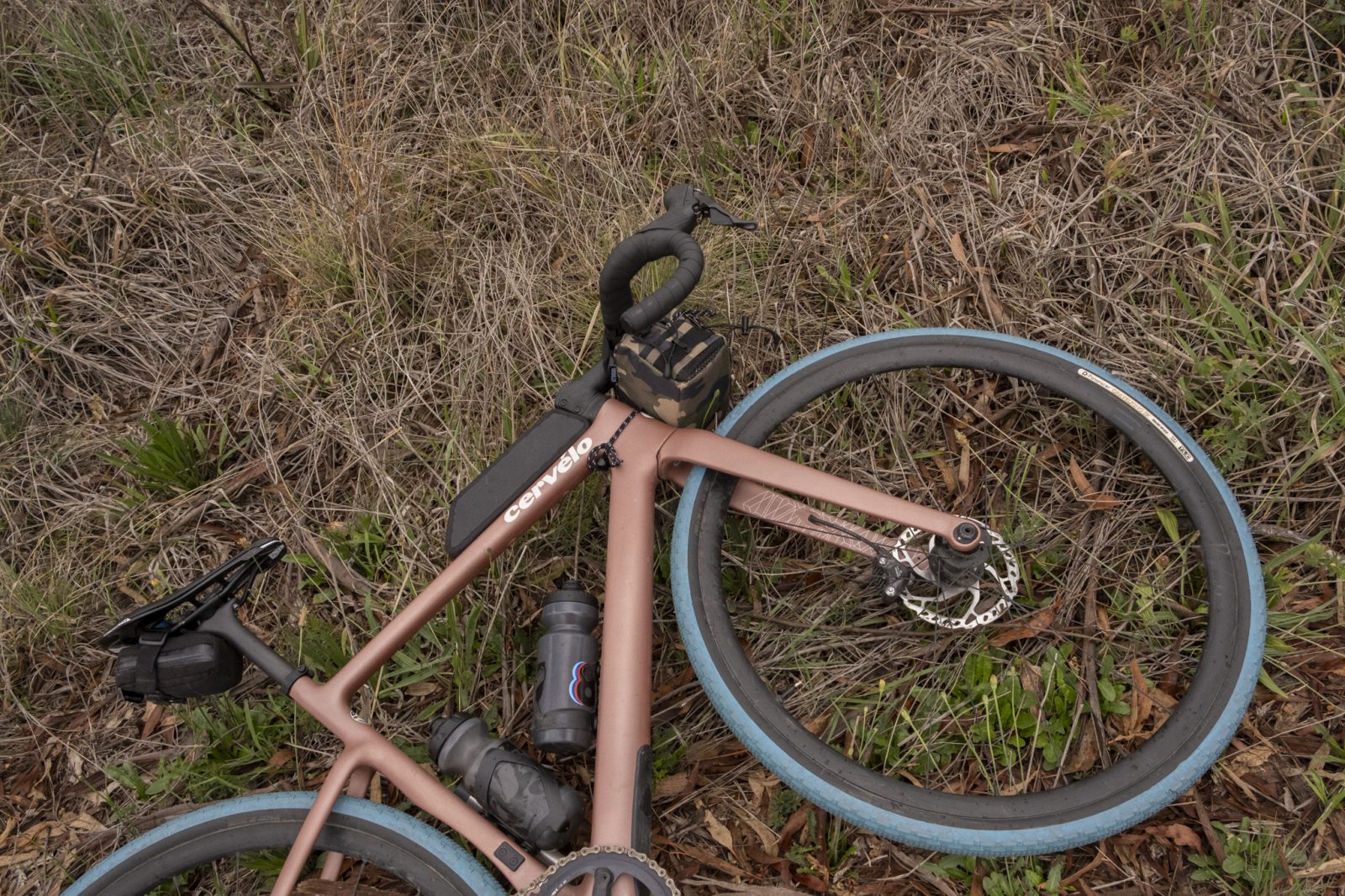
It’s well graded with a solid base, the kind of road you could probably get over with a road bike, but that’s just so much fun to plough through on a gravel bike set up with fast tyres.
Our pace picks up and everyone’s demeanour becomes more and more playful, bunny-hopping small divots and ripping little skids in the looser gravel piled between the tyre tracks.
The short and very sweet few kilometres of Beaufort Road are behind us before we know it and we turn left and back onto tarmac, but just for a quick dash to the next off-piste detour.
It’s more of the same again as we cut through expansive grazing paddocks along another stellar gravel road.
We tick over the 20km marker after what feels like barely 20 minutes, before rattling across a very broad cattle grid and onto sealed roads again.
It’s not long before we ride into the base of our second climb of the day, cheered on by a very fresh herd of sheep off to the left, the little spring lamb’s tails all still intact.
Another pretty mild lump with just a couple of ramps to sting the legs.
Approaching the top it feels like the first noticeable variation in landscape and the trees close in on both sides of the road.
The conversation turns from the primo gravel to gear, as it so often does.
Keith explains that gravel bikes have revolutionised the riding around here.
Previously most ride options had to be an out-and-back, but now the options to link up the highways with these champagne byways mean there are endless possibilities to devise loops.
Baa baa black sheep
There’s a longer stretch of chipseal ahead of us along Emmaville Road, but just like with the fun and fast descent we’ve just hit, I guess you have to earn your turn on gravel too.
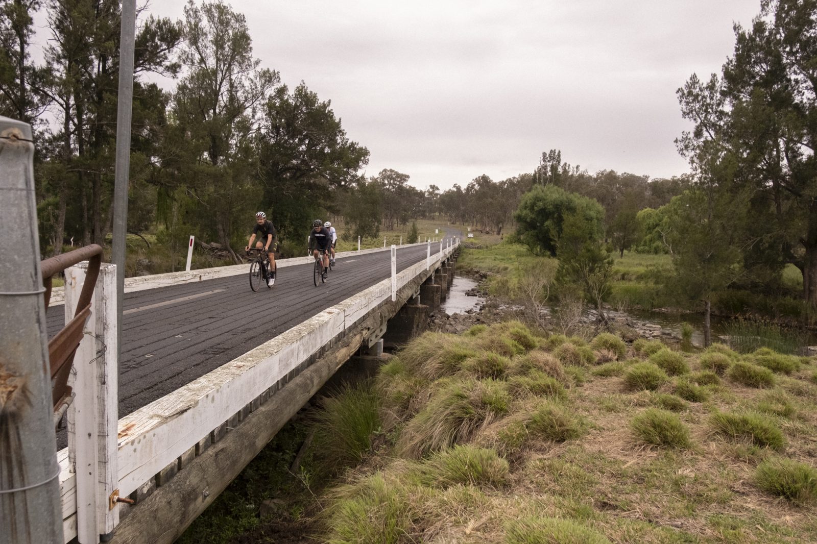
Ten kilometres more and a couple of hundred of metres altitude less and we roll up to a narrow bridge that spans the Severn River.
“Mind the gap” jokes Bernard as we begin our crossing.
We’ve been pinpointing the various place names from our ride to their British and Irish origins but his quip has nothing to do with the London Underground.
It’s a wooden bridge, grippy thanks to the asphalt coating, but there are precarious gaps between each plank running parallel to our wheels, roughly the width of a road tyre.
I do my best to choose a plank and stick to it the whole way, but I’m still glad to be running chunky 40c tyres at this point; good insurance.
Another short rise after the bridge behind us, we cash in on local knowledge once again and detour back off the main road onto our next gravel section. ‘Ever feel like you’re being watched?’ I ask Zoe.
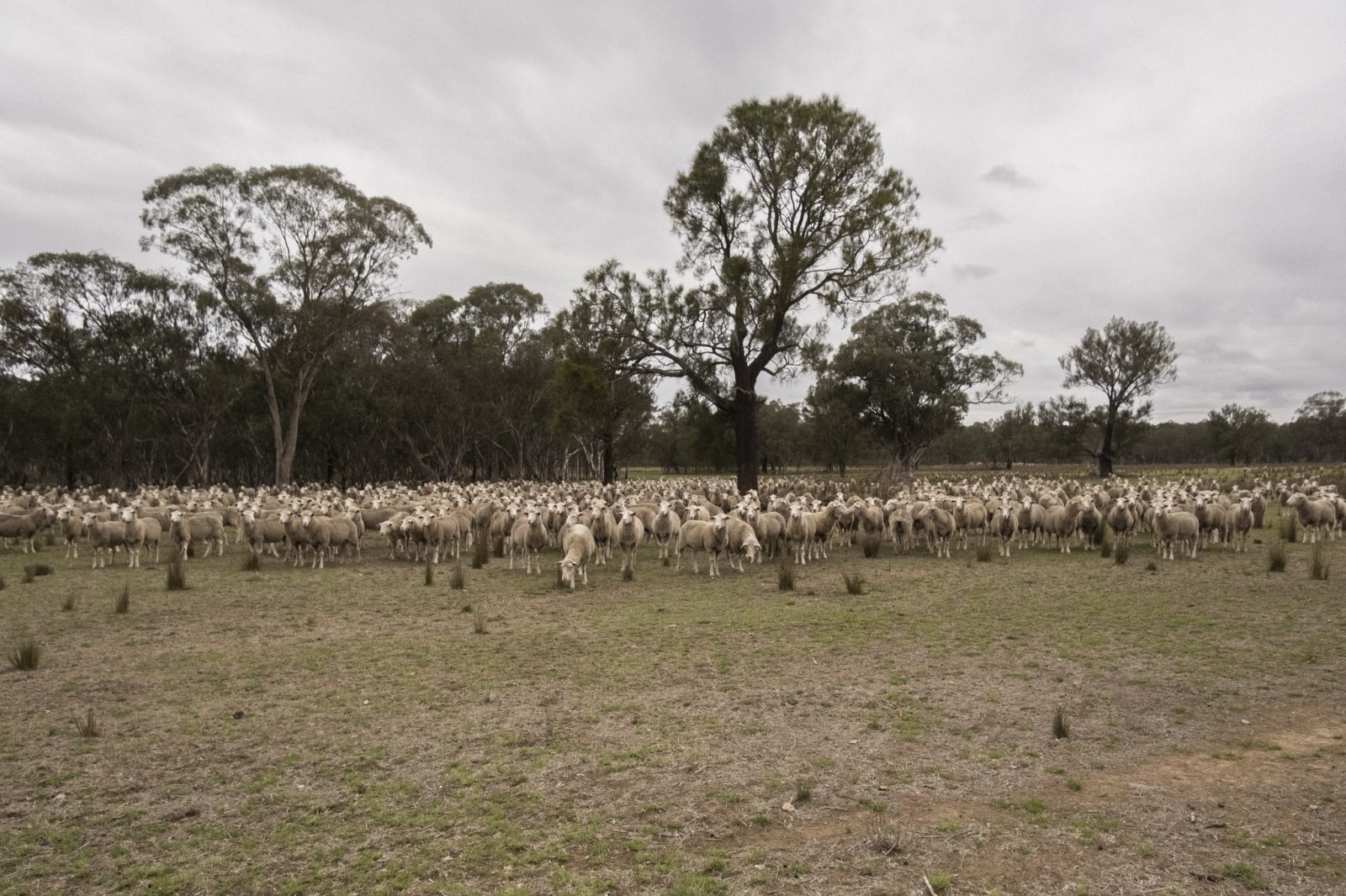
In the paddock off to our right there’s a massive herd of sheep, numbering easily in the hundreds, and this small group of lycra-clad strangers has piqued their interest.
The quiet, collective ‘baaahhh’ crescendos as the herd slowly approaches the fenceline.
It feels rude not to make a quick stop to greet them back, so we take the opportunity to grab a quick snack while we’re at it.
Wycliffe Road continues the theme of the near-perfectly groomed gravel we’re quickly becoming used to, although it’s both hands on the bars for the next stretch thanks to the washboard surface.
The corrugations are spaced just perfectly to create maximum shock, and while we all have a good laugh about how ridiculous we probably look, it’s a relief when the terrain evens back out.
Thoughts of another coffee are beginning to crowd my mind, but to stay distracted I turn my attention back to the incredible landscape out here.
There are mossy, granite outcrops and craggy tors scattered everywhere, their distinctive onion-skin appearance the result of frost wedging, a unique weathering action caused by the freezing winter conditions.
All the way into Emmaville, Zoe and I discuss the similarities to geology we’re both so familiar with in the Snowies, and I’m glad to be putting my geology degree to at least some use.
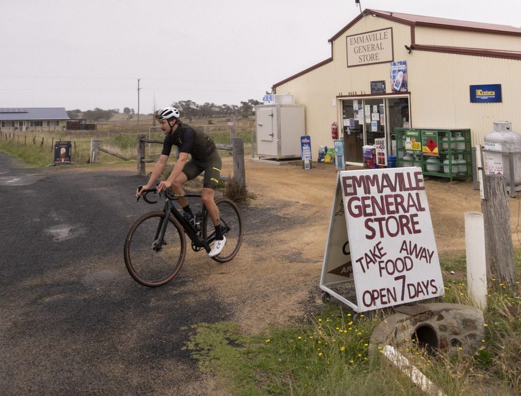
We roll into Emmaville just past the 50km mark, ready for a bite to eat.
It’s a very tidy, little, two-pub town with an amazing amount of history crammed into its bones.
The cold, highland rain that’s been threatening since we left this morning finally begins to fall and we all huddle around a sheltered picnic table across the road from the town’s beautiful old post office.
Keith’s lovely wife Jenny has driven up to meet us and with the weather rolling in, the thermos of piping hot coffee in her hand is a sight for sore eyes.
Sticking with the Scottish flavour of the day, we devour a whole packet of butter shortbread too, a fortifying snack for the drizzling ride ahead.
There’s more to this little hamlet than just two pubs and a post office and before we hit the road again, I insist on dropping into the Emmaville Mining Museum.
With the town’s tin mining history, plus a cornucopia of geological bric-a-brac on display, I could spend a full day clopping around in wet cycling shoes.
Luckily for the others the absurdity of this scene dawns on me and we press on for Torrington.
Grey sky mine
We retrace our steps back along the sealed Wellington Vale Road that took us into Emmaville, trying to warm our stiffened legs and backs up after the protracted morning tea.
Zoe gets a chance to meet my niche geological commentary with her botanical knowledge and points out a cluster of Gymea lilies off to the right, their fiery scarlet flower heads sticking out against the rain grey backdrop like two-metre-tall sore thumbs.
After a few more ginger kays, just before we pass the lonely little Tent Hill Public Hall we’d passed on the way in, we turn left to begin our descent down to the historic Ottery Mine.
The road surface is treacherously loose, especially mixed with the rain that’s still gently falling, so we keep our pace cautiously low.
Corner after sweeping corner winds us down towards the former arsenic mine and the lowest elevation of the day, revealing a bit more of the valley with each bend.
Hitting the base of the descent and crossing the Beardy River, the black surface abruptly becomes white gravel, contrasting as starkly as keys on a piano.

It doesn’t take a geologist or a botanist to know that a long descent to a river usually means an equivalent climb back up, and just like that my chain shifts from the 10-tooth to one starting with a three.
The climb starts out as a real treat because, just like the descent, the gradients are agreeable and the gravel is even more so.
The Ottery Mine site is being rehabilitated, with the old dam being transformed into wetlands to attract native birds, but this also means the perfectly graded gravel is soon to be paved.
So walk, don’t run, if you want to catch it in its Tuscan white road glory.
A few kays in, the rain begins to ease just as the climb really begins to bite.
We cross another narrow bridge before the road briefly returns to chip seal to offer some much needed traction up the 20% wall that towers in front of us.
I decide momentum is the best approach, so I stand up on the pedals to put some power down.
That plan lasts one pedal stroke and my rear tyre lets go of the road. Seated it is then.
Thankfully, the brutal gradient only lasts a couple of hundred metres before it settles into a modest (by comparison) six to 10%.
The 70km marker is behind us now and wearying legs mean we all settle into our own paces.
It’s a great opportunity to drink in the scenery which has rapidly changed from wide open paddocks to native forestland.
Rounding the last bend, the top of the climb is marked by a colossal granite monolith looming to the right.
It’s a monster of a rock and actually not even the biggest one in the region (that would be Bald Rock; the largest in Australia).
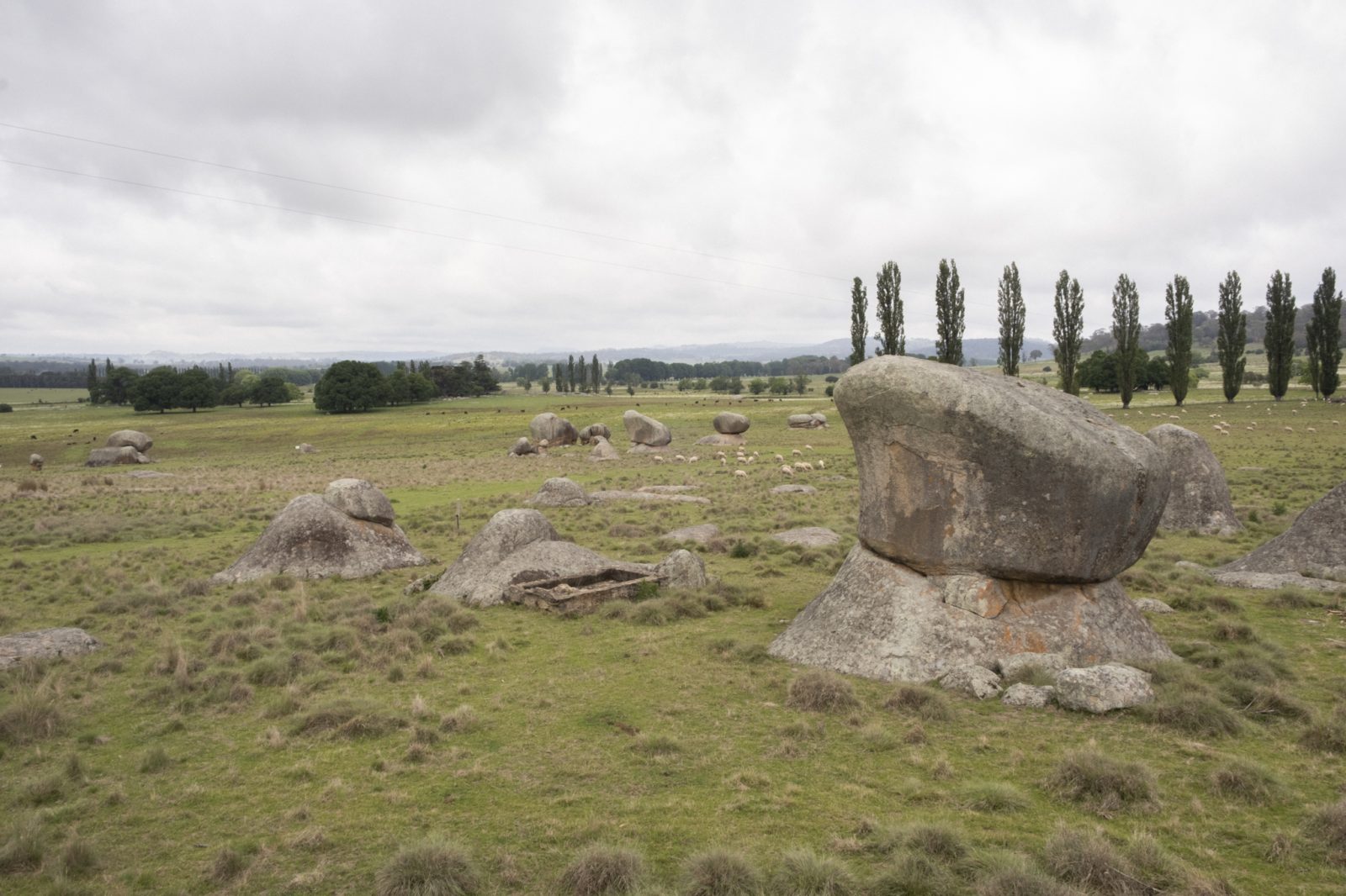
There’s no mistaking why it’s called Granite Country up here.
We regroup at a clearing over the crest before our collective attention snaps to lunch and shelter.
The conditions are playing musical chairs again; the climb has finished, the rain has begun again in earnest, the road has switched back to chipseal and we’re getting wetter and hungrier by the second.
Luckily for us, Torrington is just up the road and we find another sheltered picnic spot to grab a bite.
I’d be more than happy with a servo sandwich but Jenny meets us here instead with homemade chicken wraps and another hot beverage; truly ambrosia.
It’s just a short ride further up the track to Thunderbolt’s lookout and stunning views south across the country we’ve just ridden up.
Sadly the rain has well and truly set in by now and it’s clear that the conditions are anything but, so we pass the opportunity to have a look and make tracks for home instead.
There’s just a rolling 25km left to go and we decide our strategy is to steel our resolve in the rain and make a rapid beeline to scuttle some schooners in Deepwater.
No one in drought-prone farming regions will complain about the downpour and we’ve been very lucky to have almost no wind whatsoever to contend with, but we’re all pretty keen to get out of it nonetheless.
We dispatch one last small rise before settling in for the finale. The landscape opens back out into grazing land as we approach our destination.
There’s sheep in the paddock to the left, prime beef cattle to the right and a mob of kangaroos hopping across the road between them.
It’s a pretty stunning way to roll into town.
At Deepwater Brewing at last, soaked to the bone and in no state to be making important decisions, Zoe and I both opt for tasting paddles. The first sip of my creamy stout hits hard but goes down like silk.
Basking in the warm glow of the remarkably high ABV of my beer and the heat of the chorizo on my pizza, I reflect on why everyone around the table, and so many others, have chosen here.
For many it was arsenic and tin, for some it’s fossicking for sapphires, others it’s farming arguably Australia’s best beef.
But if seeking champagne gravel is your thing, as it is mine, then I can promise you: you’re more than covered in New England High Country.
Joel Potter is a cycling writer who ran out of time to go fossicking for sapphires on this occasion
The route we took
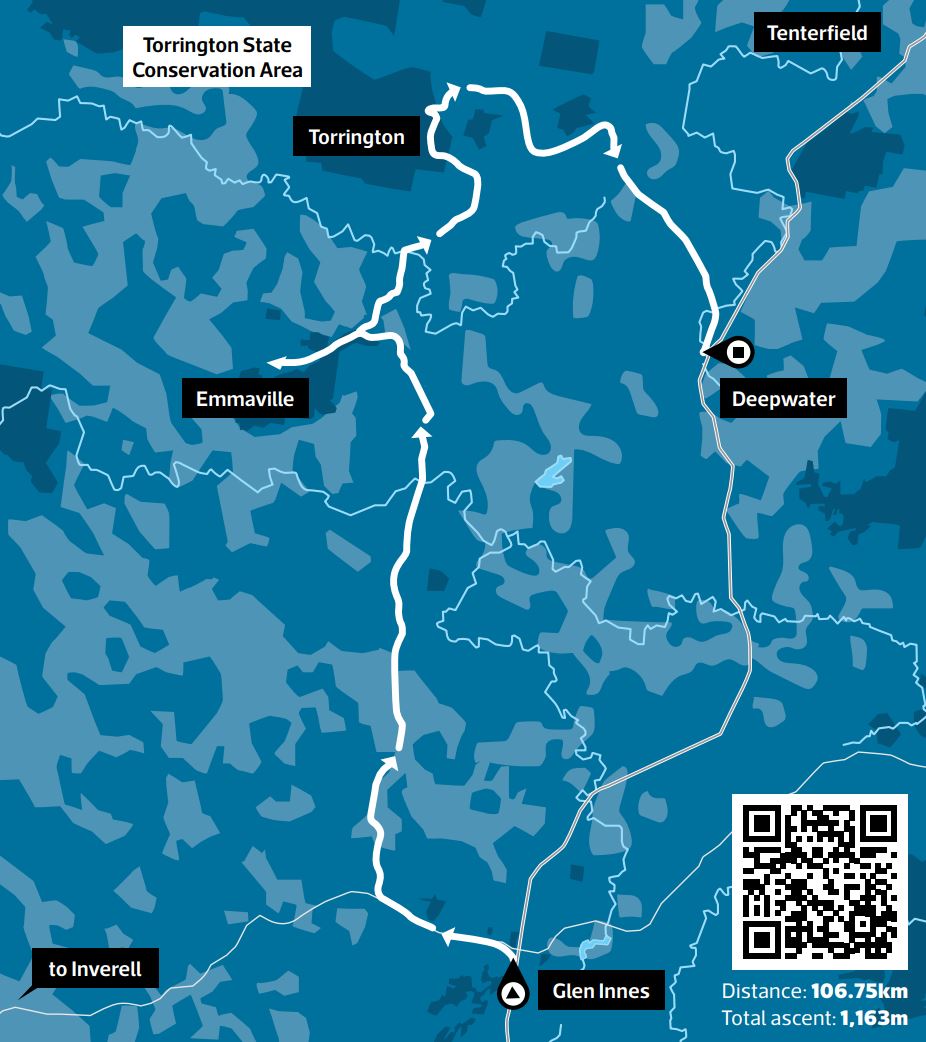
Follow in Cyclist’s wheel tracks
Starting from The Local in Glen Innes, head up Grey Street and take the first left onto Ferguson Street to head west out of town.
Ferguson Street becomes the Gwydir Highway for 6km before you detour right onto Beaufort Road and your first section of primo gravel.
At the end it’s a left onto sealed Strathbogie Road before a right after 1km onto Hamels Lane and gravel again.
This eventually spits you out onto Emmaville Road for a lumpy 18km. At the fork, swing right onto Wycliffe Road and follow the gravel until you hit Wellington Vale Road.
It’s a left turn here that takes you into Emmaville where you can refuel at the general store or the pub and browse the mining museum.
Backtrack up Wellington Vale Road until Tent Hill Road.
Take it easy down the loose chipseal descent before tackling the main climb for the day up alternating gravel and tarmac.
Eventually you’ll hit Torrington, where you go left and up to the Thunderbolts Lookout and picnic area, or simply right and into town.
You’re now on Torrington Road, which you’ll follow to a T-intersection at the 90km mark.
Go right, remaining on Torrington Road all the way into Deepwater.
Ride through town and take the right onto Wellington Vale Road to find Deepwater Brewing for that hard-earned thirst quencher.
By the numbers
Because everyone love stats
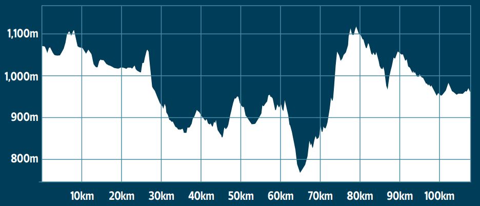
1,163 metres elevation gained
106 kilometres ridden
44 tooth sprocket required up one of the pinches
20 shortbread biscuits consumed
10 per cent ABV stout downed at Deepwater Brewing
8 cars that passed us the entire ride
0 kmh average winds all day
Don’t miss Inverell
Just up the road from our Big Ride, Inverell should be on every cyclist’s must-visit list
You can’t talk about riding in New England High Country without talking about Inverell.
Etched into the annals of Australian cycling history as the finish line of the historic Grafton to Inverell Classic, and the birthplace of Heinrich Haussler, the town has plenty to offer whether you’re a seasoned racer or you’re just clipping in for the first time.
The 228km Grafton to Inverell Classic runs annually as a men’s and women’s NRS event as well as an open event for anyone up to the challenge (graftontoinverell.com.au).
Inverell also boasts a purpose-built criterium track at Lake Inverell with races run by the Inverell Cycling Club.
For those who prefer to get dirty, there’s the Inverell MTB Park just south of town, which offers a huge variety of cross-country trails catering to all abilities, from green runs up to black diamonds.
There’s no shortage of picturesque and nearly car-free roads to explore in the surrounding countryside and a dedicated cycleway follows the beautiful Macintyre River through Inverell, perfect for families.
The historic town also has plenty of off-bike activities to keep you going, including fossicking for sapphires, exploring the Pioneer Village and for lovers of all things two, four or more wheeled, the National Transport Museum.
How we did it
TRAVEL
It’s a 7.5-hour drive to Glen Innes from Sydney and you can take either Thunderbolts Way for a real driver’s drive or opt for the New England Highway via Tamworth for a still windy but more relaxed drive.
We did one each way and either route has plenty of great rest-stop options.
It’s just a 4.5-hour drive from Brisbane down the New England Highway.
FOOD AND DRINK
Dinner on our first night was hearty pub fare at the Glen Innes District Services Club.
We ate the included continental breakfast at the Glen Innes Motel both mornings, as well as excellent coffees, baked treats, and bacon-and-egg rolls from The Local on Grey Street in the centre of Glen Innes.
Food options are limited along the route so make sure you pack enough to see you through.
There’s a general store and two pubs at the halfway point in Emmaville to refuel.
We enjoyed a great selection of award-winning beers and some much-needed pizza at Deepwater Brewing after the ride.
The Deepwater Commercial Hotel is Australia’s only ‘mental health pub’ – throughout the pub there are subtle mental-heath messages and the staff are always available for a chat – and is also definitely worth a stop.
For our last dinner we were lucky enough to be in Glen Innes for the inaugural Margarita & Taco Festival held at the historic Railway Station where we devoured yet more pizza from The Local’s stand.
ACCOMMODATION
We stayed two nights at the Glen Innes Motel, which is conveniently located on the New England Highway on the way into town and an easy ride from the centre.
Continental breakfast and free Wi-Fi is provided for all rooms.
There are plenty of great options throughout Glen Innes to choose from, including pub rooms and multiple caravan parks too.
THANKS
A big thanks to Ronnie Bombell from Glen Innes Severn Council and Lisa Kirton for coordinating and facilitating our weekend as well as introducing us to the incredible group of local riders who braved the weather with us all day.
And with that a huge thanks to Keith and Bernard for their company and vital local’s knowledge that took us on so much incredible gravel we might have otherwise missed.
More special thanks to Phil who tailed us all day in the support car and Jenny who fed us so generously throughout the ride (and made the best chicken wrap I’ve ever eaten)