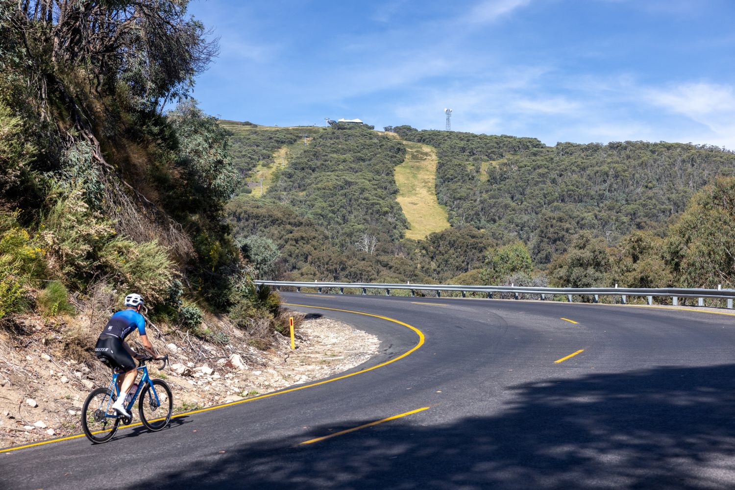
Rising up through the Delatite Valley, the climb to Mt Buller has some of the best scenery of any in Australia and is a true test for cyclists of all levels and abilities
Words and Photography NICK ESSER
Mt Buller has got to be one the best climbs in the country.
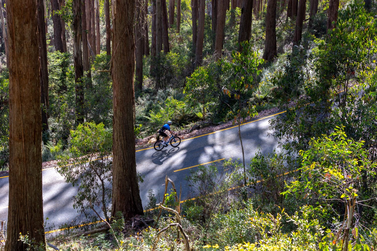
Snaking up the northern slopes of the Delatite Valley, the steady and enjoyable ascent is certainly a challenge, yet it’s also achievable for fit cyclists.
The road surface is fast and the scenery is spectacular, but the climb itself is by no means straightforward – the final kilometre rears upwards meaning that the finish at the resort village comes as quite a relief.
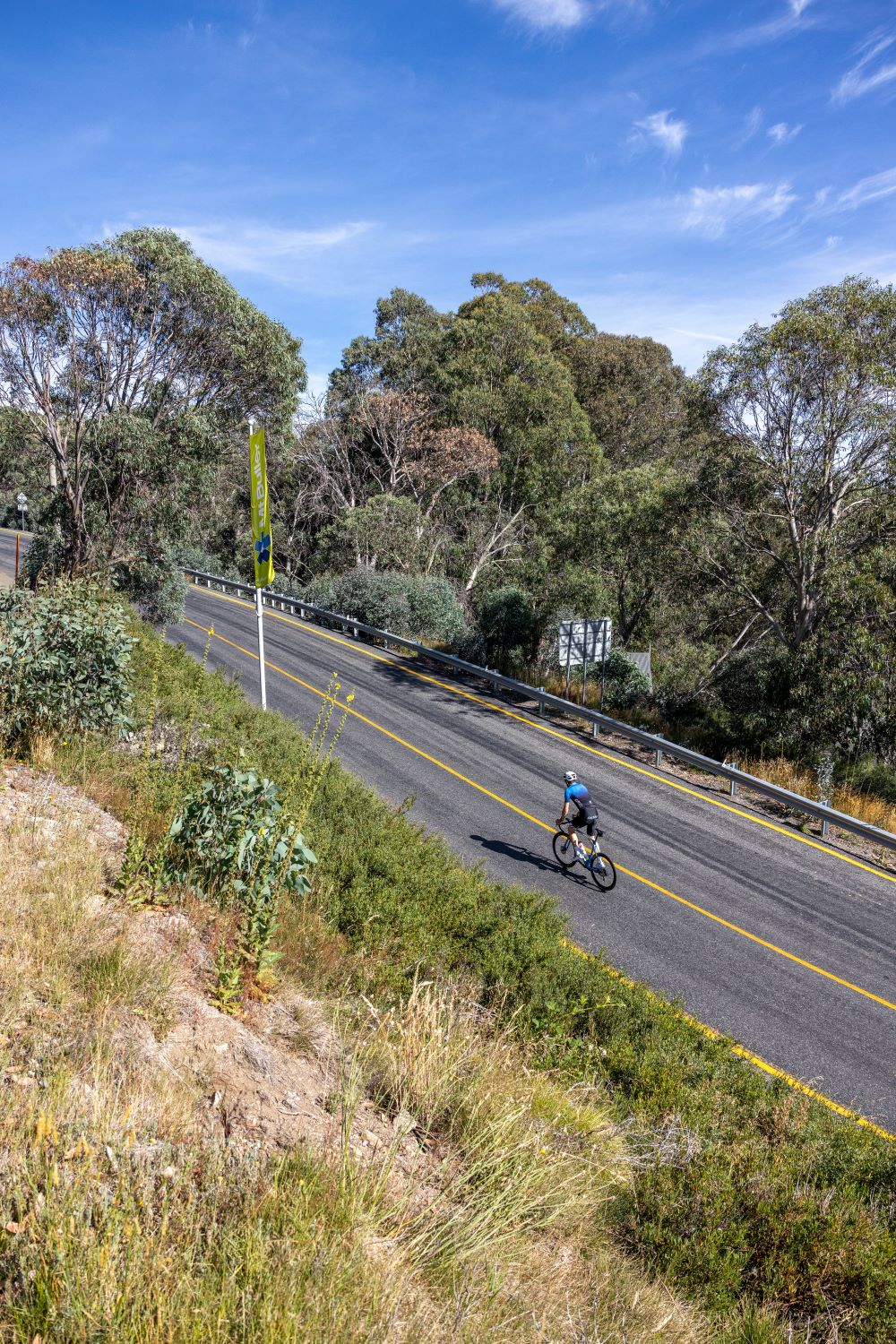
The climb begins in the former logging settlement of Mirimbah, with the road heading upwards from the resort tollbooth.
The opening kilometres are solid and the gradient sits at around 6%, but it’s consistent and easy enough to slot into the rhythm of the climb.
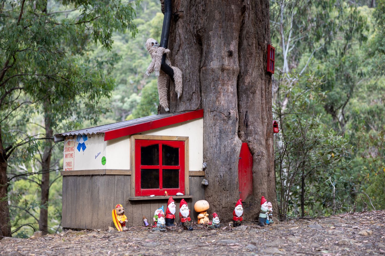
A curious site appears on the left-hand side of the road – Mt Buller’s famous Gnome Tree.
No one is quite sure when they first moved in and it seems like the population fluctuates somewhat, but the gnomes have built a home in the trunk of a large eucalypt about 3km into the climb.
Not long after the gnomes, a gentle right-hand bend reveals spectacular views through the sub-alpine forest and out across the Delatite Valley.
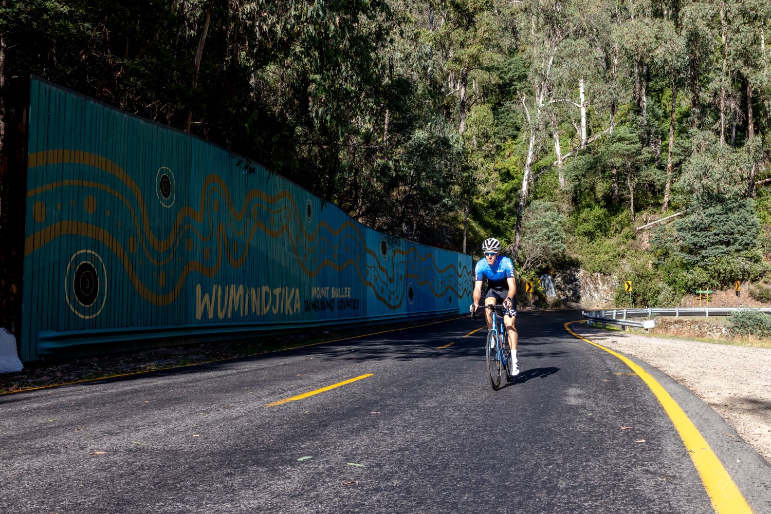
The vistas continue for a couple of kilometres until you reach White Bridge and the site of a significant landslide in 1986.
The once brown and substantial retaining wall has, in recent years, been painted by a local Indigenous artist welcoming visitors to Taungurung Country – appropriate as the mountain is a site for traditional ceremony and home to the famous bogong moths, which provided an important source of food during the summer months.
Around the halfway point of the climb and just after Chalet Creek, the road veers upwards past a snow-chain fitting bay and the snowplough sheds on the right.
This is the steepest section of the road so far, with the gradient ramping up to 11%.
Half-way home
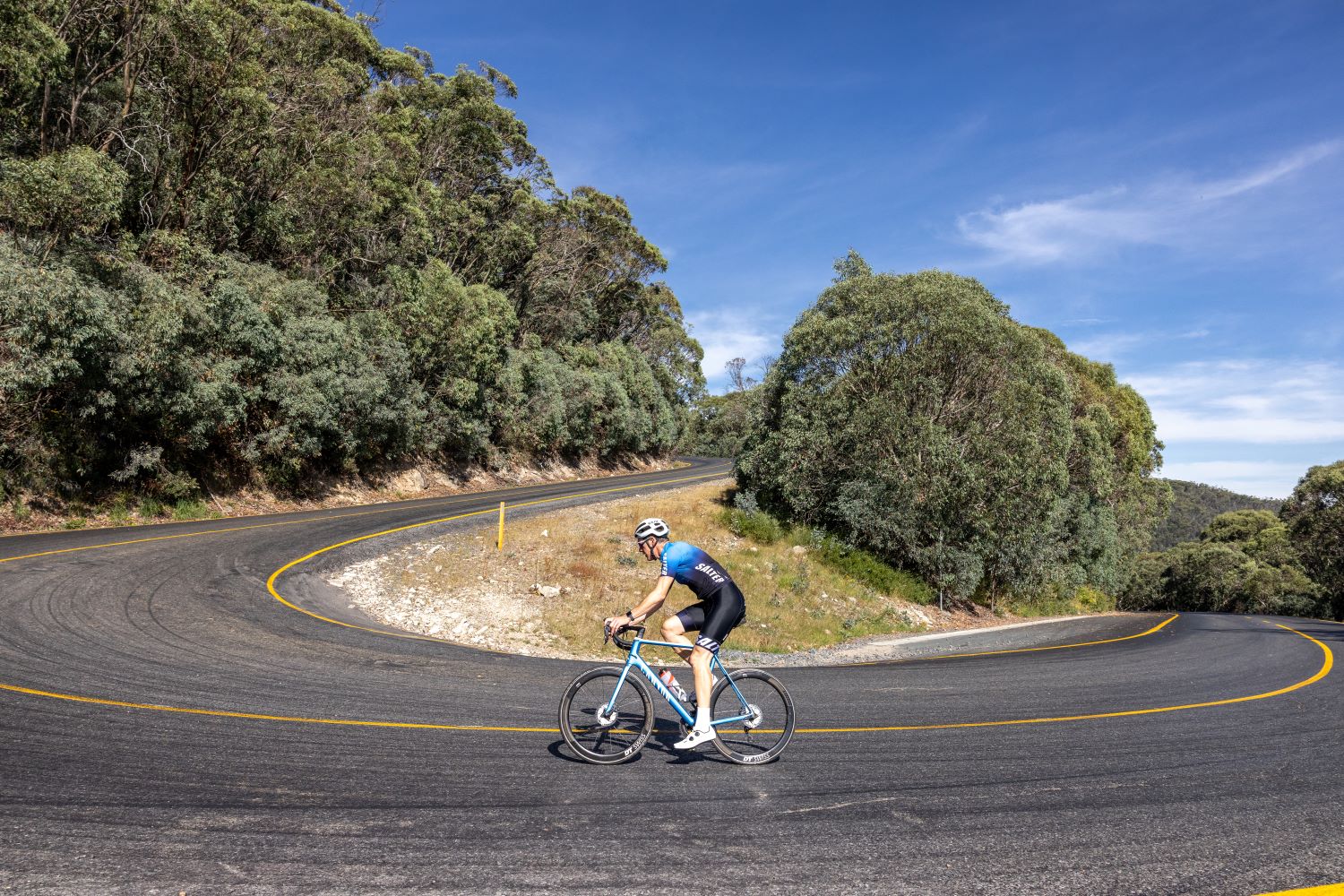
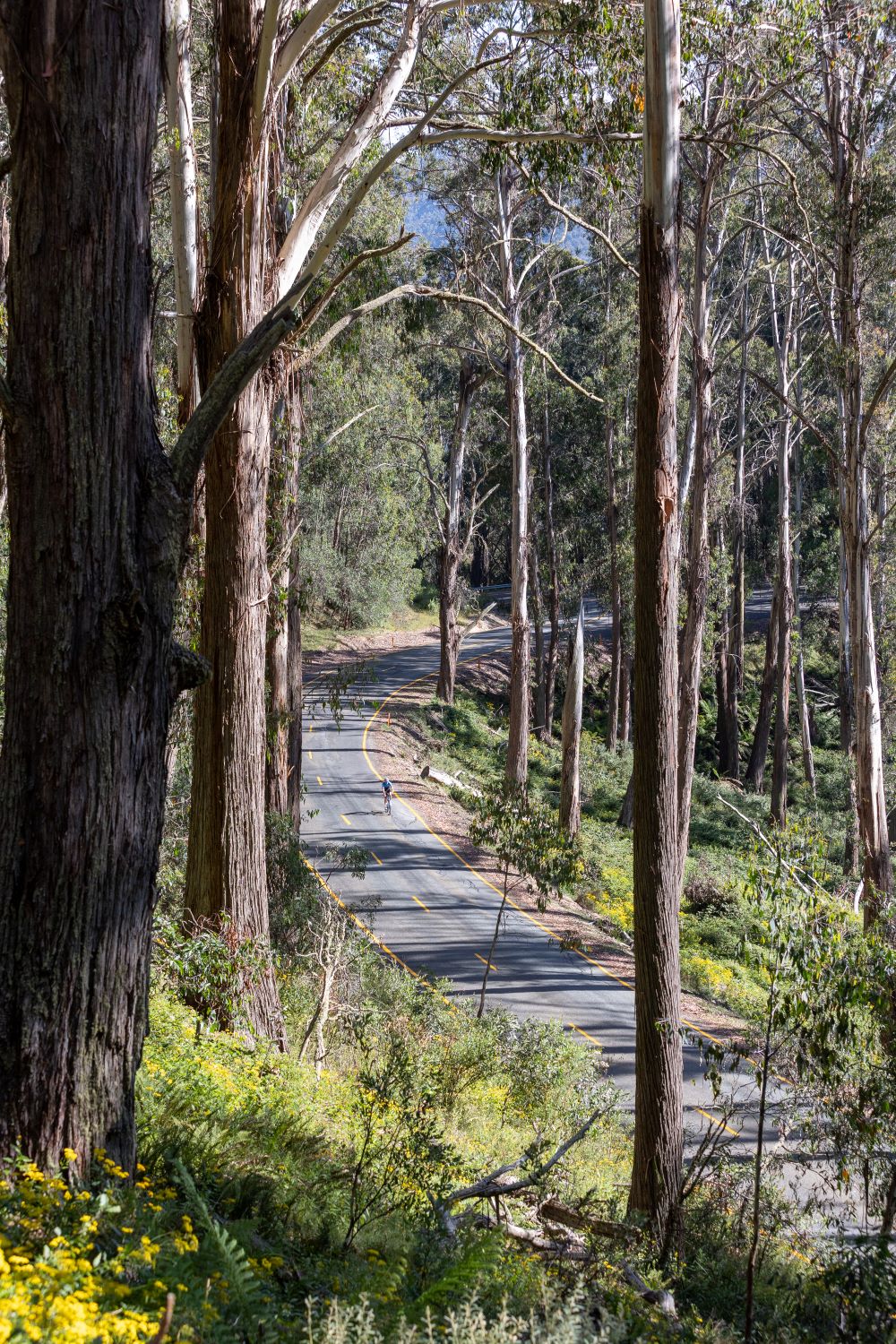
A kilometre or so further up the road is the wonderfully named Unnamed Corner.
This right-hander signposts a section of challenging hairpins, with the road relentlessly winding back on itself for the next handful of kilometres.
This is the first real opportunity for climbing specialists to go on the offensive.
The climb has a rich racing history.
The Mansfield – Mt Buller Road Race has been a favourite stop on the Victorian calendar for decades and the climb has featured on and off in the Herald Sun Tour over the years.
It’s also the former stomping ground of Mansfield local and Australian cycling royalty Simon Gerrans.
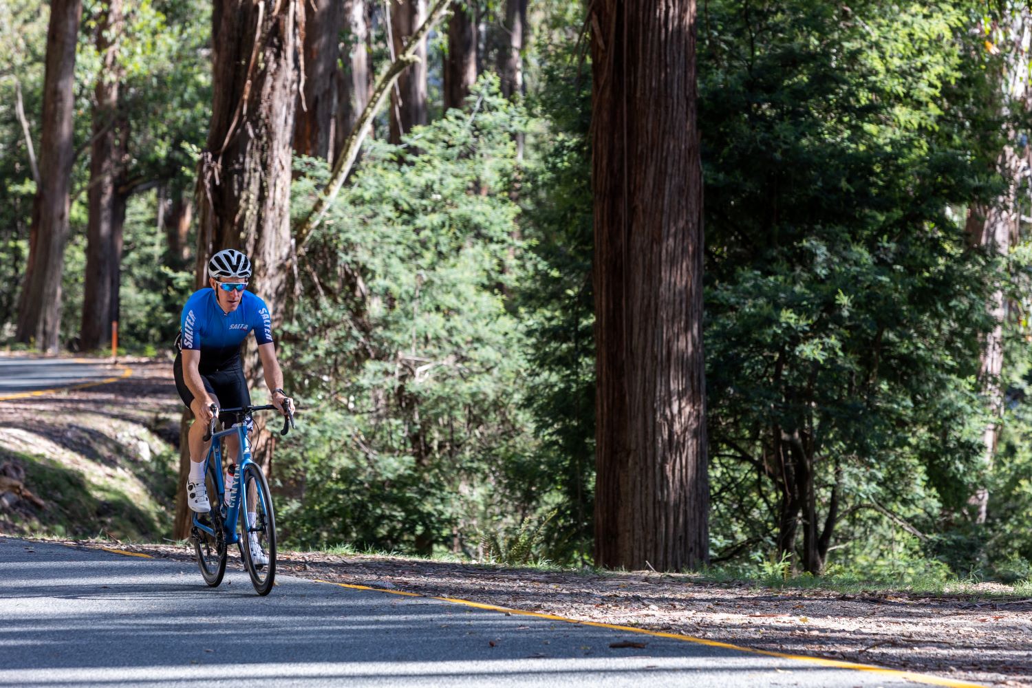
The numerous hairpins also create a terraced effect, with views through towering mountain ash and fibrous woolybutts back down to the road below.
These eucalypts line the road and define the climb, moving upwards through the forest.
Unlike Mt Hotham, the whole climb is below the tree line, creating a wonderful sense of arrival when, 13km into the climb, a long left-hand bend through a clearing in the canopy reveals Mt Buller’s northern slopes.
Here the climb levels off for a moment, passing under the Horse Hill Chairlift and through the skating rink car park.
It’s around this point that the forest recedes, and the ghostly snow gum emerges, thriving at an elevation beyond which all other trees are able to weather.
Now, nearly 14km in the climb, the road heads upwards once more and into its final section.
The appropriately named Hell Corner tops out at a gradient of about 13% and is shortly followed by another sharp hairpin.
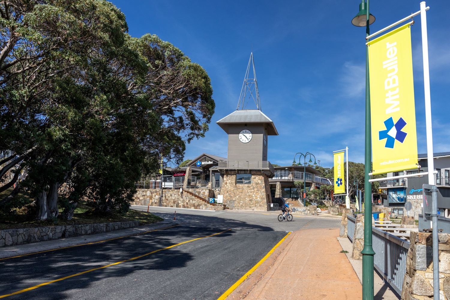
From here it’s another 700 metres of steep climbing until the entrance to the village.
Officially the climb ends at the clocktower intersection, but those with surplus energy might choose to continue up the Summit Road to the top of Bourke St – an additional 900 metres with an average gradient over 10%.
Feeling Bullish
In terms of times up the climb, anywhere around the hour mark is a great achievement for the competitive cyclist.
However, it’s hard to resist the temptation to compare yourself to the KOM of 37 minutes – an average speed of 24kmh – set by reigning Giro d’Italia winner Jai Hindley during the queen stage of the 2020 Herald Sun Tour.
Although much more relaxed in the green season, Mt Buller’s village is open year-round and there are a few year-round options for an end-of-climb coffee and bite to eat.
The Whitt and Kooroora Hotel are popular. There’s also the Mirimbah General Store at the base of the climb.
Recently renovated and under new management, it’s probably the pick of the bunch.
Mansfield is the obvious place to the start the ride.
Out and back, it’s a solid 95km past lush farms and along rolling hills before the climb up Mt Buller itself.
For those pressed for time or just focused on the climb itself, heading off from Merrijig is a good option too, offering 12km to warm the legs before the climb begins.
As with any hors catégorie climb, it’s best to be prepared.
In the mountains the weather can change quickly and even in the middle of summer it’s worth carrying a vest or jacket for the fast descent.
The upside of this is that it’s perfect spot to escape the heat in January, with temperatures at the village usually 10 degrees cooler than in the valley below.
Mt Buller is about 260km north-east of Melbourne, so while it’s possible as a day trip, it’s worth staying the night.
There are accommodation options on the hill or nearby in Mansfield.
There’s also plenty of road riding options from Mansfield to justify a couple of days in the region.
Mt Buller also offers an extensive mountain bike trail network with both cross country and downhill options and quality mountain bikes available for hire in the village.
And there’s limitless potential for epic gravel adventures throughout Victoria’s High Country.
Mt Buller
The Map
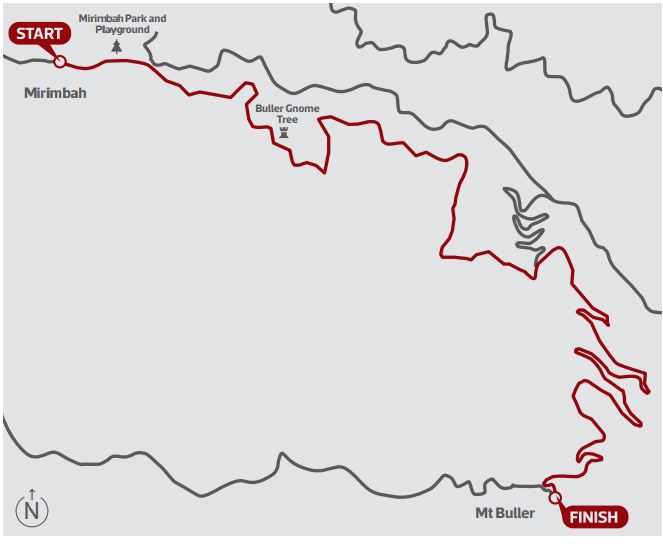
Location Victoria’s High Country
Start Mirimbah
Finish Mt Buller
Road Mt Buller Road (C320)
The Stats
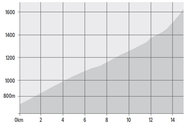
Summit height 1,668m
Total ascent 942m
Distance 15.30km
Average gradient 6.2%
Maximum gradient 13% (Hell Corner)
Current best Strava times
KoM Jai Hindley 37:57
QoM Grace Brown 47:32